Maps have been an indispensable tool for navigating the world since the earliest civilizations. They have evolved from simple sketches on papyrus to sophisticated digital creations, reflecting advances in technology, exploration, and our understanding of the planet.
Ancient Origins: Parchment and Paper Maps
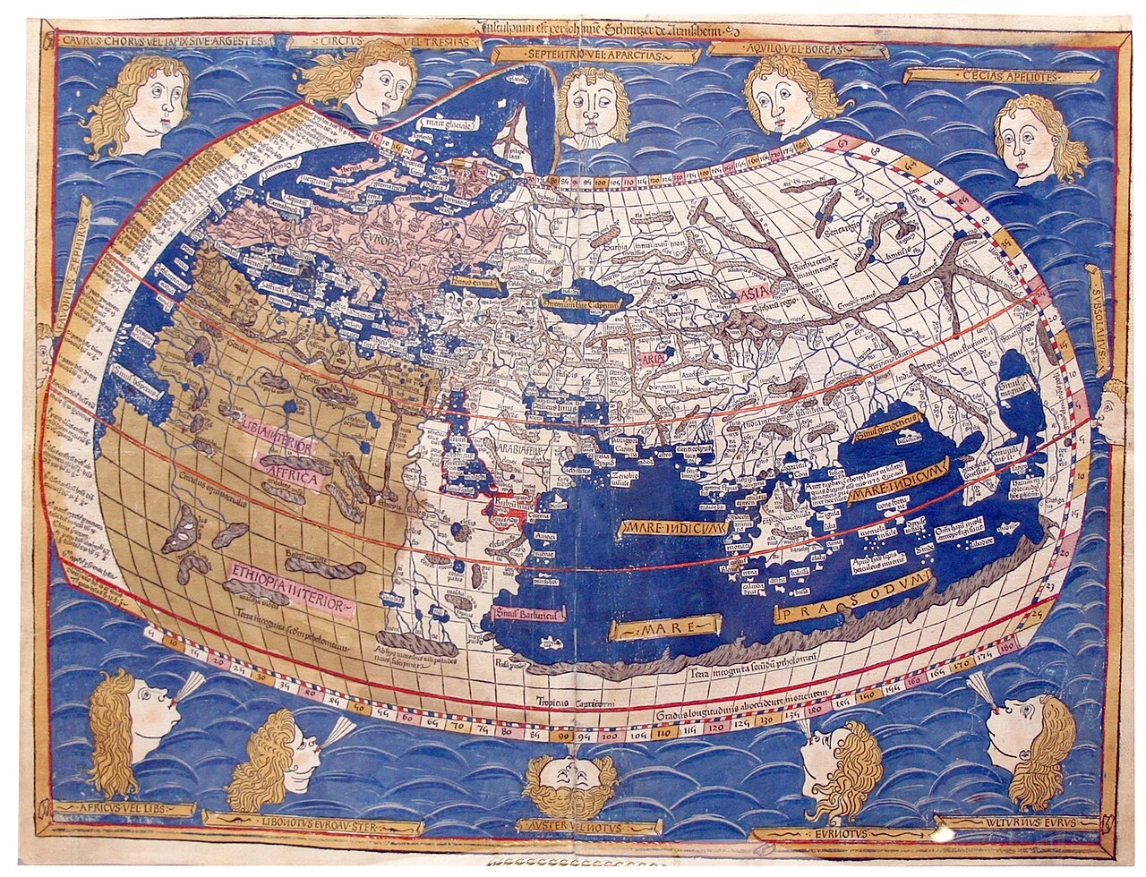
The earliest known maps date back to ancient civilizations in Mesopotamia and Egypt. These maps were often simple drawings on clay tablets or papyrus, depicting the surrounding landscape and landmarks. As civilizations developed, so did their cartographic techniques. The Greeks and Romans made significant contributions to mapmaking, introducing concepts such as scale and longitude.
The Middle Ages: The Rise of Portolan Charts
During the Middle Ages, portolan charts became the dominant form of mapmaking. These charts, primarily used for navigation, focused on coastlines, islands, and ports. They were often decorated with intricate compass roses and wind symbols, reflecting the importance of maritime trade during this period.
The Age of Exploration: Charting the World
The Age of Exploration brought about a revolution in mapmaking. As explorers ventured into new territories, they brought back detailed information about coastlines, waterways, and mountain ranges. This information was used to create increasingly accurate maps of the world, opening up new trade routes and fueling further exploration.
The Scientific Revolution: Precision and Accuracy
The Scientific Revolution brought about a renewed interest in science, including cartography. Mapmakers began to incorporate scientific principles into their work, using mathematical formulas and astronomical observations to create more precise and accurate maps.
The Industrial Revolution: Mass Production and Standardization
The Industrial Revolution led to the development of new printing techniques, which made it possible to mass-produce maps. This, in turn, led to the standardization of mapmaking, with cartographers adopting common symbols and conventions.
The Digital Age: Maps in the Modern World
The advent of computers and digital technology has transformed mapmaking. Today, maps are created and accessed with the click of a mouse, and they can be updated in real-time. Digital maps have become an essential tool for navigation, planning, and research.
The Future of Mapmaking: A World of Possibilities
The future of mapmaking is bright. With the continued development of technology, we can expect to see even more sophisticated and interactive maps. These maps will incorporate real-time data, 3D visualizations, and artificial intelligence, providing an unprecedented level of information and insight about our world.
Conclusion: The Enduring Legacy of Maps
Maps have played a vital role in human history, helping us to navigate, explore, and understand our world. They continue to evolve and adapt to our changing needs, providing us with a valuable tool for navigating the future.


