Historical maps have long been cherished as valuable tools for understanding the past. They provide insights into the geography, cultures, and events that have shaped our world. Today, thanks to advances in technology, historical maps are becoming even more engaging and informative. In this blog post, we will explore some of the new technologies and applications that are shaping the future of historical maps.
Interactive Maps
One of the most exciting developments in historical cartography is the rise of interactive maps. These maps allow users to zoom in and out, pan across the map, and click on different features to learn more about them. Interactive maps can also be used to overlay different layers of data, such as population density or trade routes. This provides users with a more comprehensive understanding of the past.
Virtual Reality and Augmented Reality
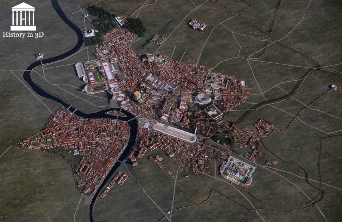
Virtual reality (VR) and augmented reality (AR) are also being used to create immersive experiences that bring historical maps to life. With VR, users can put on a headset and be transported to a different time and place. They can explore ancient cities, walk through battlefields, and experience historical events firsthand. AR, on the other hand, overlays digital information onto the real world. This allows users to see historical maps superimposed on their surroundings.
Crowdsourcing
Crowdsourcing is another trend that is transforming historical cartography. Online platforms are making it easier for individuals to contribute their knowledge and expertise to mapmaking projects. This is leading to the creation of more detailed and accurate historical maps.
Data Science
Data science is also playing a role in the future of historical maps. By analyzing large datasets of historical data, scientists are able to uncover new patterns and trends. This information can then be used to create more informative and insightful maps.
Applications
The new technologies and applications that are being developed for historical maps have a wide range of potential applications. These maps can be used for education, research, entertainment, and even urban planning.
- Education: Historical maps can be used to teach students about history, geography, and culture. They can also be used to develop critical thinking skills.
- Research: Historical maps can be used to research historical events, migration patterns, and trade routes. They can also be used to identify potential archaeological sites.
- Entertainment: Historical maps can be used to create interactive games and simulations. They can also be used to develop virtual and augmented reality experiences.
- Urban planning: Historical maps can be used to understand the history of a city or region. This information can then be used to inform urban planning decisions.
The future of historical maps is bright. With the help of new technologies and applications, these maps are becoming more engaging, informative, and accessible than ever before. As we continue to explore the past, historical maps will play an increasingly important role in our understanding of the world.


