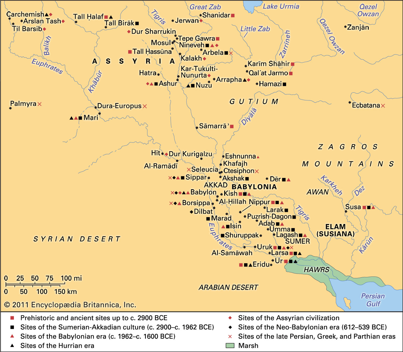
Maps, with their intricate lines and vibrant colors, are not merely tools for navigation; they are also windows into the past, revealing the stories of civilizations long gone. Historical maps, frozen snapshots of a world in time, hold immense power to transport us back in time, offering insights into the political landscapes, trade routes, and cultural beliefs of our ancestors.
Unveiling Political Landscapes
Historical maps provide a fascinating glimpse into the political dynamics of the past. They delineate the boundaries of empires, kingdoms, and city-states, revealing the rise and fall of power structures and the shifting balance of influence across continents. By studying these maps, we can trace the expansion of empires like the Roman Empire or the Ottoman Empire, and witness the emergence and decline of major powers.
Charting Trade Routes and Economic Networks
Historical maps also unveil the intricate web of trade routes that connected civilizations across vast distances. They depict the movement of goods and ideas along ancient Silk Roads, maritime routes that spanned oceans, and inland networks that linked cities and villages. These maps provide insights into the economic networks that fueled trade, fostered cultural exchange, and shaped global economies.
Deciphering Cultural Beliefs and Worldviews
Historical maps, imbued with symbolism and decorative elements, offer valuable insights into the cultural beliefs and worldviews of civilizations past. They often incorporate religious imagery, mythological creatures, and allegorical representations of the world, reflecting the prevailing understanding of geography and the cosmos. These maps serve as visual repositories of cultural narratives and beliefs, providing a window into the minds of our ancestors.
Visualizing Historical Narratives
Historical maps, when combined with historical records and archaeological evidence, transform into powerful tools for visualizing historical narratives. By overlaying historical events, population shifts, and cultural developments onto maps, we can create animated maps that bring history to life, allowing viewers to grasp the complexities of the past in a dynamic and engaging manner.
Preserving and Sharing the Legacy of Historical Maps
Historical maps, as tangible artifacts from the past, are invaluable cultural heritage. Museums, libraries, and archives around the world are dedicated to preserving and digitizing these precious documents, ensuring that they remain accessible to researchers, scholars, and the public alike. By sharing these maps through exhibitions, online platforms, and educational resources, we can foster a deeper appreciation for the historical significance of maps and their enduring ability to tell stories of the past.
Conclusion: Maps as Bridges to the Past
Historical maps, with their intricate details and captivating narratives, serve as bridges between our present and the past. They invite us to embark on journeys through time, exploring the political landscapes, trade routes, and cultural beliefs of civilizations that have come and gone. By engaging with these maps, we gain a deeper understanding of the roots of our world and the enduring legacy of human endeavors.
